

Like many developing nations, Nigeria has been grappling with infrastructure development for many years. The country has been facing challenges with providing essential infrastructure such as roads, water supply, and electricity, which are critical for economic growth and development. However, with technological advancements, drones and mapping are emerging as new tools that can be used to fast-track infrastructure development in Nigeria.
Significance of Infrastructure Development in Nigeria
Infrastructure development is crucial for economic growth and development in Nigeria. With a population of over 200 million people, providing basic infrastructure is essential for the well-being of the citizens and the evolution of businesses. Infrastructure development enhances productivity, reduces poverty, creates employment opportunities, and attracts foreign investments, among other benefits. However, despite being the largest economy in Africa, Nigeria still needs to catch up in infrastructure development due to various challenges such as corruption, inadequate funding, and poor planning.
The Role of Drones and Mapping in Infrastructure Development
Drones and mapping are emerging as new tools that can be used to overcome some of the challenges faced in infrastructure development in Nigeria. Drones can be used for various tasks, such as surveying, mapping, and monitoring construction sites. With their ability to capture high-resolution images and data, drones can provide accurate and up-to-date information about the progress of infrastructure projects, which can help to identify and address any issues that may arise. Mapping, on the other hand, can provide valuable insights into the existing infrastructure and help identify areas requiring urgent attention.
Benefits of Drones and Mapping in Infrastructure Development
Using drones and mapping in infrastructure development in Nigeria has numerous advantages:
- It can reduce the time and cost of infrastructure projects by providing accurate and real-time information, which helps to identify and address any issues before they escalate.
- It can improve the quality of infrastructure by ensuring that construction projects are completed to the required standards.
- It can enhance transparency and accountability in the infrastructure development process by providing accurate and accessible information to stakeholders.
1: Mapping Nigeria’s Infrastructure Needs
With a population of over 200 million, Nigeria is Africa’s most populous nation and the continent’s largest economy. However, the country’s infrastructure development must catch up with its growing population and economic potential. The state of infrastructure in Nigeria could be better, with inadequate roads, railways, ports, and airports, which hampers economic growth and development.
There is a need to identify areas that require infrastructure development to address this challenge, and mapping can be a valuable tool in achieving this. Mapping can help in identifying infrastructure gaps and opportunities and also help in the efficient allocation of resources to the areas that need them the most.
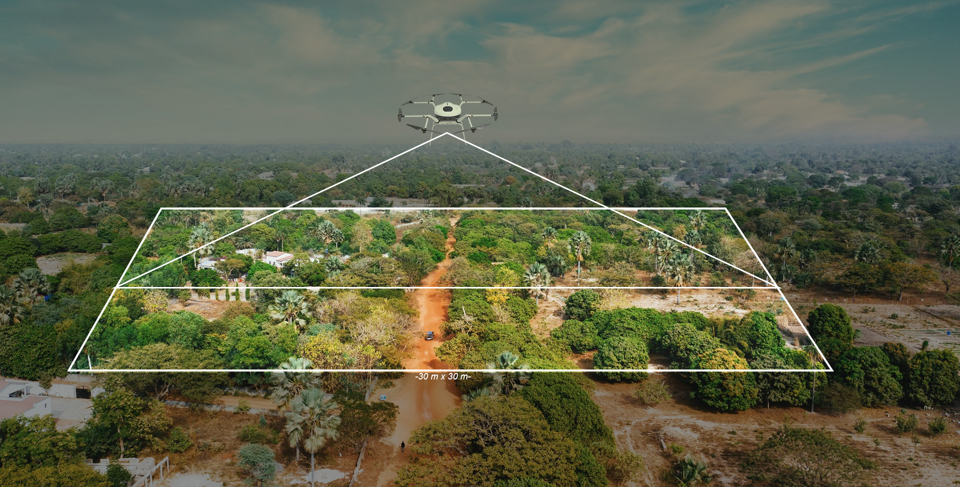
Using drones for mapping has become an increasingly popular method in recent times. Drones can cover vast areas quickly, and they are cost-effective compared to traditional mapping methods. They can also provide high-resolution images, videos, and other types of data that can be used to create detailed maps essential for infrastructure development.
The benefits of using drones for mapping Nigeria’s infrastructure needs are numerous. Firstly, it allows for more efficient identification of infrastructure gaps and opportunities, effectively allocating resources. It also enables the collection of real-time data that can be used to monitor the progress of infrastructure development projects. Drones can monitor construction sites, assess the quality of construction work, and identify any issues that need to be addressed.
- Enhancing Infrastructure Development with Drones
Infrastructure development is crucial for the growth and development of any country. In Nigeria, there is a need to improve the state of infrastructure in various sectors, including transportation, energy, and communication. Drones can enhance infrastructure development in Nigeria by providing data and monitoring services. In this blog post, we will discuss how drones can be used for infrastructure development in Nigeria, highlight how drones have been used for infrastructure development in other countries, and explain the advantages of using drones for infrastructure development in Nigeria.
Using Drones for Infrastructure Development in Nigeria
Drones can be used for various purposes in infrastructure development in Nigeria. For example, they can be used to survey and map construction sites, monitor the progress of construction projects, and inspect infrastructure such as bridges, dams, and pipelines. Drones can also collect data on the condition of roads, buildings, and other infrastructure, which can be used to plan maintenance and repair work.
Drones have been used for infrastructure development in other countries as well. In the United States, drones have been used to inspect bridges and wind turbines, survey construction sites, and monitor the condition of roads and other infrastructure. In Rwanda, drones have been used to deliver medical supplies to remote areas, and in Australia, drones have been used to survey and map mining sites.
Advantages of Using Drones for Infrastructure Development in Nigeria
Using drones for infrastructure development in Nigeria has several advantages. First, drones can provide data and monitoring services that are more accurate and cost-effective than traditional methods. For example, drones can provide high-resolution images and videos of construction sites, which can be used to monitor progress and identify potential problems. Drones can also be used to collect data on the condition of infrastructure, which can help to prioritize maintenance and repair work.
Second, using drones for infrastructure development can improve safety. Drones can inspect infrastructure, such as bridges and dams, which can be dangerous for humans to access. Using drones can reduce the risk of accidents and injuries.
Third, using drones for infrastructure development can save time and money. Traditional methods of collecting data and monitoring infrastructure can take time and effort. Using drones can reduce the time and cost of these activities, speeding up infrastructure development projects.
- Overcoming Challenges and Making progress
While using drones for infrastructure development in Nigeria has numerous benefits, some challenges also need to be addressed. In this section, we will discuss some of the challenges that may arise when using drones for infrastructure development in Nigeria, provide possible solutions to overcome these challenges, and describe how mapping and drones can work together to enhance infrastructure development in Nigeria.
Challenges of Using Drones for Infrastructure Development in Nigeria
Regulatory compliance is one of the main challenges of using drones for infrastructure development in Nigeria. There currently need to be clear regulations governing the use of drones in Nigeria, which can make it difficult for companies to obtain permits to operate drones. Another challenge is requiring more skilled personnel to operate and maintain drones. Additionally, there may be resistance from local communities who need to become more familiar with drone technology and may be concerned about privacy and security issues.
Possible Solutions to Overcome These Challenges
There are several possible solutions to overcome the challenges of using drones for infrastructure development in Nigeria:
- The government can develop clear regulations and guidelines for using drones, which can help companies obtain permits and operate drones safely and legally.
- The government can invest in training programs to develop the skills of drone operators and maintenance personnel.
- Companies can engage in community outreach programs to educate local communities about drone technology and address their concerns about privacy and security.
Mapping and Drones for Infrastructure Development in Nigeria
Mapping and drones can work together to enhance infrastructure development in Nigeria. By using drones to collect data and mapping technology to analyze it, it is possible to develop accurate and detailed infrastructure maps, such as roads, bridges, and buildings. These maps can be used to identify areas that require maintenance or repair, plan new infrastructure projects, and monitor the progress of construction projects. Mapping and drone technology can also monitor and manage natural resources, such as forests and water resources, critical for infrastructure development.
Conclusion
In this article, we have discussed the potential of using drones and mapping technology to enhance infrastructure development in Nigeria. We highlighted how drones could be used for infrastructure development, the challenges that may arise, and the possible solutions to overcome these challenges. We also discussed how mapping and drones could work together to provide accurate and detailed information for infrastructure development.
Infrastructure development is crucial for the growth and development of Nigeria. It can improve transportation, energy, and communication systems, which are essential for economic growth and social progress. Drones and mapping technology can help to accelerate infrastructure development in Nigeria by providing accurate and cost-effective data and monitoring services.
To fully harness the potential of drones and mapping technology, there is a need for clear regulations and guidelines, training programs, and community outreach efforts. We must work together to create an environment that fosters the adoption and use of these tools in infrastructure development efforts in Nigeria.
In conclusion, infrastructure development is an essential priority for Nigeria, and using drones and mapping technology can help accelerate progress in this area. Policymakers, industry leaders, and other stakeholders must collaborate and adopt these tools to drive infrastructure development in Nigeria forward. With the proper support and investment, Nigeria can unlock the full potential of these tools and build a brighter future for its citizens.